Select Theme

  • Default Theme
  • Blue Theme

Text Size

  • Increase Text Size
  • Decrease Text Size
  • Normal Text Size

Current Size: 100%

Skip to main content

Screen Reader

Select Language

  • English
  • हिन्दी
  • ਪੰਜਾਬੀ
this is logo image

Main menu

  • Home
  • About Us
    • About the Department
    • Organization Brief / Structure
    • Agriculture Extension and Training
      • Agriculture Extension And Training
      • ATMA
      • Agriculture Information
    • Punjab Agriculture Council
    • Sugarcane
  • Acts / Orders
  • Crops
  • MSP
  • Publication
  • Institution
  • Gallery
    • Photo Gallery
    • Video Gallery
  • Schemes
  • Contact Us
  • Recruitments

Search form

Sidebar Menu

  • Agriculture Extension and Training
  • Plant Protection
  • E- agriservices
  • Agriculture Inputs
  • High Yielding Variety Programe
  • Seeds
  • Goverment Seed Farms
  • Cash crops
  • Cotton
  • Maize
  • Punjab State Council
  • OilSeed
  • Pulses
  • Agriculture Marketing
  • Agriculture Engineering Wing
  • Farm Mechanization
  • Hydrogeological Wing
  • Map
  • Agriculture statistics
  • Crop Cutting Experiments
  • Sugar Cane
  • Census
National Portal of IndiaDigital India
  1. Home
  2. Welcome To District Barnala(Punjab)--Introduction
Welcome To District Barnala(Punjab)--Introduction

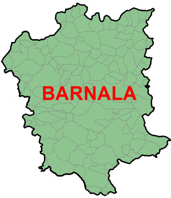
Barnala image

Barnala was declared district in Nov. 2006 by partitioning the earst while Sangrur district. The topography is plain at an elevation of 228.86 meter above mean sea level. Barnala is a small district both in terms of population and area. It is situated on rail line between Bhatinda and Dhuri on Bathinda-Ambala-Delhi section and also on Ludhiana- Bhatinda road .The district is surrounded by Ludhiana and Moga districts in North, Sangrur district in East, Mansa district in South and Bhatinda district in South- west. Barnala district has only one sub division namely Barnala. There are three blocks, 130 villages and 158 Gram Panchyats.
The total geographical area is 141000 ha. Total population of district was 526931 amounting to 2.1% of Punjab state according to 2001 census. The number of women per thousand was 871. The rural population was about 392409, is 74% of total population. The literacy rate was 52 %. Literacy rate of urban population was 60%, where as literacy rate in rural population was 49%. The population density was 376 per square kilometer. As per data collected from villages there were 92014 households in this district. Out of which 27604(30%) were scheduled caste and 7361(8%) were of backward classes. The scheduled caste literacy rate was only 30% out of which 62% male and 38% are female.All the families have housing facility. The housing condition varies with size land holdings. 29604(32%)houses have RCC roofs and 62410 (64%) have roofs made of brick tiles The source of drinking water in villages are taps and submersible pumps. Every village have facility of drinking water. Regarding latrine facilities 27604 (30%) house holds are using flush type and 55208 (60%) are using bore-hole latrine within their houses. The remaining 9201(10%) households were using public latrines. 206 kilometer internal roads in the villages are made of bricks with uneven surface need to be made of concrete.615 Km. approach roads also require repairs. In addition to this 255 Km. additional connecting roads are required to be made so that farmers can approach easily. All villages got electrified but supply of electricity is poor in kharif season due to higher demand for paddy crop. The supply remains 4-6 hours with lot of tripping and under voltage. There are 91 self help groups in the district. Most of the groups are non-functioning. With the efforts of extension staff through ATMA scheme groups are being activated with motivation. All most all the villages have primary/upper primary schools. Enrollment of boys 32331 is higher than girls 28641. The attendance of boys is 82% as compared to girls 91%. Among Scheduled caste students boys are 7135 and 6580 girls in upper primary/Senior. Secondary schools.

AttachmentSize
PDF icon Intro (This document is in English language)15.3 KB
PDF icon General Information Of Villages And Population (This document is in English language)21.53 KB
PDF icon District Monthly Rain Fall Data (This document is in English language)15.55 KB
PDF icon Soil Fertility Indices Of District Barnala (This document is in English language)25.05 KB
PDF icon Present Status Of Productivity And Potentials (This document is in English language)15.84 KB
PDF icon Development Of Agriculture Sector, District Barnala (This document is in English language)26.66 KB
PDF icon Contacts Details:-CHIEF AGRICULTURE OFFICER Pharwahi Bazar, Barnala,Contact Number 01679-231166 (This document is in English language)15.09 KB
Last Updated: 21/10/2022 - 4:01pm

Footer Links

  • Copyright Policy
  • Hyper Linking Policy
  • Privacy Policy
  • Terms And Conditions
  • Disclaimer
  • Site map
  • Help
  • Accessibility Options
  • Feedback

Content available on the website is owned maintain by - Official Website Of Department Of Agriculture & Farmer Welfare, Government Of Punjab,India
Copyright © 2017-All Rights Reserved-Official Website of Department of Agriculture & Farmer Welfare,Government of Punjab,India

anadolu yakası escort bayan

escort bursa görükle escort bayan

bursa escort görükle escort

güvenilir bahis siteleri canlı bahis siteleri kaçak iddaa siteleri kaçak iddaa kaçak bahis siteleri perabet

görükle escort bursa eskort bayanlar bursa eskort bursa vip escort bursa elit escort escort vip escort alanya escort bayan antalya escort bayan bodrum escort

Valid CSS! WCAG -AA Valid XHTML 1.0 Transitional acheker